BhumiVikas Land Development is a Durgapur-based land planning consultancy built for landowners, promoters, housing societies and industrial developers who need their land to perform. For over eighteen years we have worked the soil of Paschim Bardhaman — measuring it, studying it, drawing it and preparing it for what comes next.
Our work begins long before a single boundary stone is placed. We study the topography, soil behaviour, access potential and statutory land-use classification of every parcel we take on. That groundwork tells us what is genuinely buildable, what needs engineering, and where the real value of the land sits — long before budgets are committed.
From there, our planning team develops a master layout that respects the natural drainage of the site, creates a logical road hierarchy, and places plots, open spaces and utility corridors where they deliver the strongest long-term return. Every drawing we produce is prepared to withstand scrutiny from approving authorities and technical auditors alike.
We also understand that land development in Durgapur is as much a documentation exercise as it is a design one. Our team prepares and coordinates the survey records, layout submissions, conversion paperwork and infrastructure drawings required through the approval journey, keeping the process transparent and predictable for our clients.
Whether you own a small residential plot cluster on the outskirts of Durgapur or a multi-acre parcel earmarked for a township, our approach stays the same: measure honestly, plan carefully, document completely and deliver on time. That discipline is why promoters across the region return to us project after project.

Nine core land development planning services engineered for Durgapur's growing residential, commercial and industrial corridors.
Before a single rupee is invested, we establish exactly what your Durgapur land parcel can legally and practically support. Our feasibility studies examine access roads, soil bearing capacity, flood history, adjacent development patterns and prevailing land-use norms to produce a clear, decision-ready picture.
The output is a concise feasibility report that tells you the realistic development potential, the constraints that will cost money, and the approvals likely to be required — so you can negotiate, budget and plan with confidence rather than assumption.
Learn More
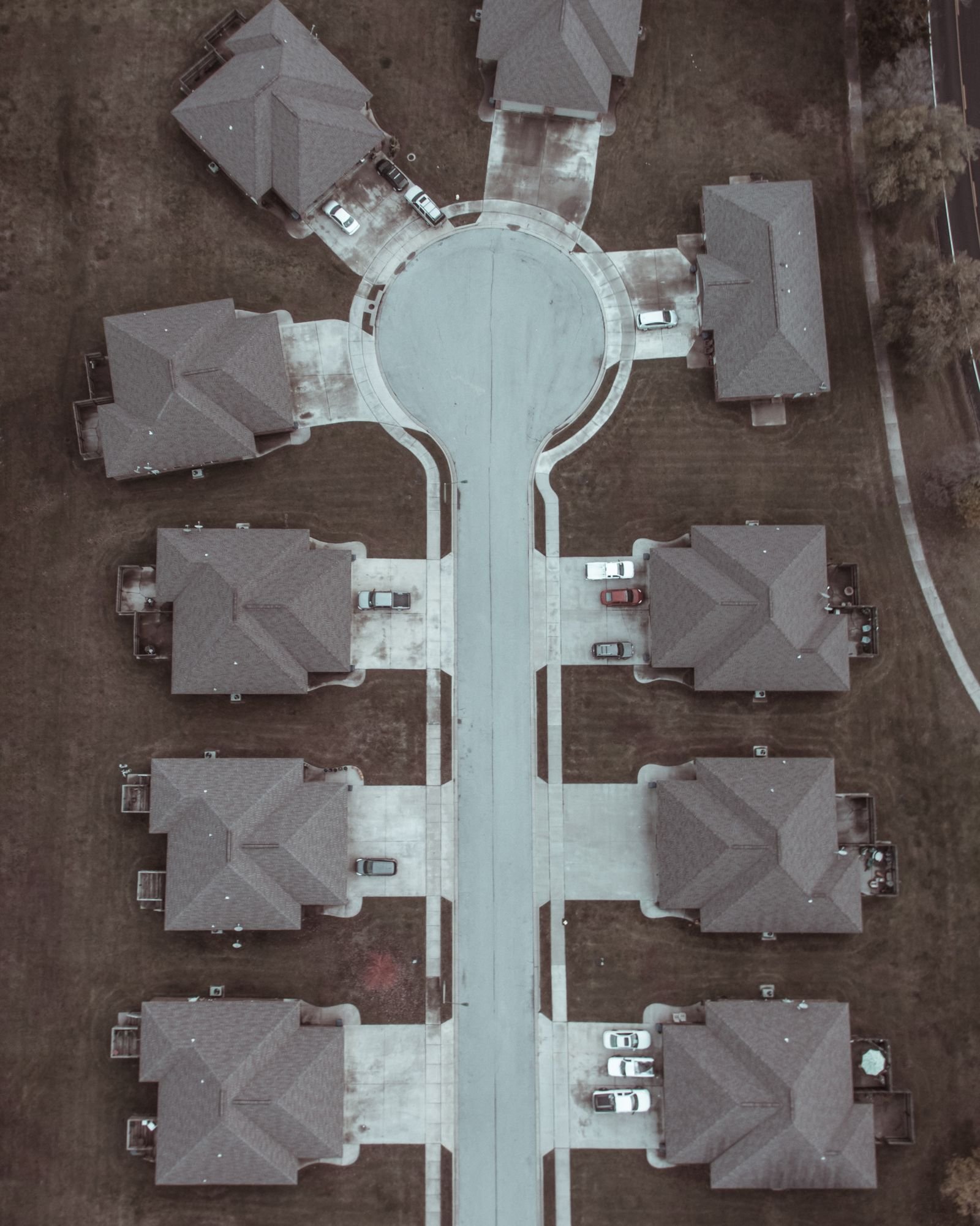
Our master layout service converts a raw land parcel into an organised, sellable and buildable neighbourhood. We determine plot sizes, road widths, junction geometry, setbacks and open-space distribution in line with local planning standards and market demand.
Every layout is optimised for yield without sacrificing liveability — we test multiple plot-mix options so you can see how different configurations affect total saleable area, infrastructure cost and overall project viability before committing to a final plan.
Learn More
Land classification rules decide what you can build, how much you can build and how quickly approvals move. Our zoning consultants review the current land-use status of your Durgapur parcel and map the shortest compliant route to your intended development.
Where a change of land use or conversion is needed, we prepare the supporting technical justification, land schedule and drawings that authorities expect, reducing back-and-forth and keeping your project timeline intact.
Learn More
Accurate ground data is the foundation of every good layout. Our survey teams use total station and GPS-based methods to capture levels, boundaries, existing structures, water bodies and vegetation across your site with centimetre-level precision.
The collected data is processed into clear digital terrain models and contour maps that drive cut-and-fill calculations, drainage design and plot grading — helping you avoid costly surprises during earthwork and construction.
Learn More
A layout only works when water, power, sewage and communication services reach every plot efficiently. We design the underground utility network — water supply lines, sewerage, storm drains, electrical ducting and street lighting — as one coordinated system.
Our infrastructure drawings include trench details, manhole schedules and service corridor reservations, giving contractors a buildable set of documents and giving buyers confidence that the development is properly serviced.
Learn More
Roads are the skeleton of any layout. We design hierarchical street networks — arterial, collector and access roads — with correct carriageway widths, turning radii, cul-de-sacs and pedestrian links that keep traffic flowing safely through the development.
Our circulation plans also account for future traffic growth, emergency vehicle access and junction sight lines, so your Durgapur project remains functional and compliant years after handover.
Learn More
Poor drainage is the single most common failure point in land development. We model runoff patterns, calculate peak discharge and design a stormwater network that carries monsoon load away from plots without erosion or waterlogging.
Where required, we integrate retention ponds, recharge pits and bioswales into the layout — turning a necessary engineering cost into an attractive landscape feature that also supports groundwater replenishment.
Learn More
Approvals can make or break a land project. Our documentation team assembles the complete submission set — layout drawings, land schedules, ownership records, technical notes and undertaking formats — tailored to the authority handling your file.

We track submissions, respond to queries and coordinate with survey and municipal offices on your behalf, giving you a single point of accountability through the entire clearance process.
Learn More
Open spaces sell land. We design parks, green buffers, avenue plantation and community gathering areas that meet statutory reservation norms while genuinely enhancing the everyday experience of residents.
Planting is selected for local Durgapur climate conditions — low water demand, high shade value and minimal maintenance — so the landscape matures beautifully without becoming a long-term burden on the maintenance budget.
Learn MoreA visual record of layouts, surveys, earthworks and completed land development projects across Durgapur and the surrounding region.


Short walkthroughs and explainers on how we approach land development planning — from feasibility to final handover.
Landowners, promoters and society members across Durgapur on what it's like to plan a project with BhumiVikas.
"I owned a little over three acres near Andal More and had no idea how to take it forward. The BhumiVikas team surveyed the land, explained the zoning position honestly and gave me a layout that sold out faster than I expected. Their feasibility report alone saved me from a very expensive mistake."
"Our society needed the layout regularised and the drainage reworked after years of waterlogging. The documentation support was thorough and the drawings were accepted without a single objection. What impressed us most was how patiently every committee question was answered."
"We have worked with several planners over the years and the difference here is the level of detail in the infrastructure drawings. Utilities, road widths, manhole positions — everything was coordinated in one set. Our contractor finished the external works ahead of schedule."
"I needed a clear technical opinion on a parcel near the industrial belt before purchasing it. The team's site analysis covered access, soil condition and flood risk in a way that a normal property agent simply cannot. The report was worth every rupee and gave me real negotiating strength."
"Partitioning and developing ancestral land is emotionally difficult as well as technically complex. BhumiVikas handled the survey, the layout and the approvals with great sensitivity and kept all family members informed at every stage. We finally have a clean, sellable layout."
"Their plotting design increased our saleable area by nearly eleven percent compared to our earlier internal plan, without touching the open space requirement. That single change paid for the entire consultancy fee several times over. We now use them for every Durgapur project."
Search below to quickly find the answer you're looking for.
It covers everything required to convert a raw parcel into a buildable, approvable layout — feasibility study, topographic survey, land-use verification, master layout and plotting, road and utility design, drainage planning, landscape reservation and the documentation needed for statutory approvals. We handle the full chain rather than isolated drawings.
A feasibility study and survey usually complete within two to three weeks. Master layout preparation takes another three to five weeks depending on parcel size and complexity. The approval period varies by authority and land classification, but we provide a clear stage-wise timeline after the initial site assessment so you always know what comes next.
Yes. We prepare the complete technical submission set, coordinate with the relevant survey and municipal offices, and track the file through the approval process. While final sanction always rests with the authority, our documentation is prepared to minimise queries and delays.
We work across the spectrum — from small residential plot clusters under an acre to multi-acre parcels intended for township or industrial development. The methodology scales; only the depth of survey and engineering detail changes with size.
Fees are quoted per project based on parcel area, scope of services and the level of approval support required. After a site visit and brief discussion we issue a written scope with a fixed fee, so there are no open-ended charges or surprise additions later.
Absolutely. Durgapur and the wider Paschim Bardhaman region are our home ground, but we regularly take up assignments across West Bengal and neighbouring states. Survey mobilisation and site visits are planned in advance so distant projects run just as smoothly.
Share your parcel details and our planning team will get back to you with a clear next step.
Fill in the form and our planning team will contact you within one working day.